


Essential Question:
How are the Earth, atmosphere and cultures all connected?
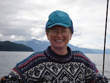
[Photos: "Self Portrait, Boat, the Sea" by Fritz Koschmann; SV the Great Sea 40' catamaran, designed by Phil Bolger, built by Fritz Koschmann in Gustavus, registered in Glacier Bay -- used for Weather Bureau satellite ground-truthing in Icy Strait; whale watching (humpbacks) at Pt. Adolphus; daily and overnight charters in Icy Strait and Glacier Bay -- (I'm the deckhand/naturalist/cook!)]
Looking at the layers of Google Earth, the holistic aspect of the earth’s form superimposed by “oceans” of atmosphere and actual water bring a better world into focus. Offering this to students, giving opportunities and TD/You Tube/other info and imagery can bring to life your own world and an interest in your own sense of place and culture upon the land and sea.
Weather is something everyone can relate to.
Cirrus curling high-level wispy locks of hair
Stratus layer featureless forming sheets
Cumulus heap tall, lumpy clouds
Nimbus rain clouds bringing precipitation
Doing Weather Bureau work on our boat, the Great Sea, in Icy Strait to “ground truth” satellite information, we were given satellite photos to judge the Beaufort scale patterns on the waves. I found a better source of illustrations, and use it to this day, in the book titled
Rising of the Wind: Adventures Along the Beaufort Scale.
[The illustrator shows Beaufort #1 to #13, one per page; each page is divided into 3 parts of a tryptych, showing the wind's effect on land, near shore, and at sea; ocean waves are creatively illustrated and were immediately recognizable while I was recording the # on the Beaufort Scale for each scientific data entry in Icy Strait weather work.]Those who spend days and lives on the sea have to recognize wave shapes, light patterns on water, to stay safe.
With students, it’s great searching local and regional weather maps online, or better yet visiting an airport weather station, showing day to day print outs visibly showing high and low pressure areas and changes. Interest is generated in weather work and cartography at a young age. I found this out staying with the “weather lady” of Yakutat one week in winter, and watching students come to look at maps.
- What resources or ideas do you have to help students visualize their invisible atmosphere?
Living in Glacier Bay, ice and glaciers are of constant interest to students. Learning about the scientific caves drilled for short-term investigations in Norway, plus Antarctic ice sheet facts and other global ongoing changes bring ice powerfully alive: “ If all land ice melted away, the global average sea level would rise about 266 feet, with the Antarctic ice sheet contributing about 240 feet and the Greenland ice sheet contributing about 25 feet. “; Buried beneath Antarctica’s ice sheets is one of the world’s largest lakes – Lake Vostok – a body of water cut off from the rest of the planet since before the human race evolved. ” These facts invite students to research these and other elements of earth, atmosphere, and cultures.
- What are the practical values of Teachers' Domain and National Geographic digital resources for your professional purposes?
Explanations of convection ( heat and mass transfer); atmospheric currents (wind); coriolis force; evaporation-condensation systems; wind zones; latitude importance to regional patterns; and climate patterns are creatively expressed and easily understood in the National Geographic, NASA, and TD videos and presentations.
- Why is it difficult to discuss weather apart from the role of the ocean?
poet, who wrote:
for neither would blasts of wind arise in the clouds and blow out from within them,
except for the Great Sea,
nor would the streams of rivers
nor the rainwater in the sky exist but for the Sea;
but the Great Sea is the begetter
of clouds and winds and rivers."
by Xenophanes
sea and the atmosphere, both "oceans" we live within and between; then write their own
image-full words relying on their own experiences. [Kenneth Koch in Sleeping on the Wing uses science concepts for basing poetry using free association with concepts and words, including fascinating works by students of all ages.]
I give the following awards:
- Most Interesting -- Explore AK! Fran
- Best Writing - Arctic Updates Richelle
- Best Design--EUUC Kaye (like the photos down the side—how’d you do that??)
- Best Links -- GeoIntegrations Jennifer
- Best of Show! -- AK Culture & Geoculture Class Kelly
- Honorable Mention - Ben's (lots of teacher resources)


What a nice synthesis of poetry, imagery and science. A natural connection, I think.
ReplyDeleteKate, I'm enjoying you interesting blog. Watch out.... blogging can become addictive.
ReplyDelete